The ENHANCE project has released a new short video introducing its mission to support sustainable and resilient coastal management across Europe.
The video highlights how ENHANCE combines AI-driven analytics, Copernicus satellite data, in-situ observations, and citizen science within a One Health framework that links environmental, human, and animal health. It also presents the project’s key innovations, including its data exchange platform, AI-powered One Health Toolkit, and stakeholder-driven Living Labs.
Featuring real-world case studies in Spain and Greece, the video demonstrates how ENHANCE is addressing pollution, climate-driven risks, and ecosystem degradation in coastal areas.
Funded by the European Union and running from 2024 to 2027, ENHANCE brings together seven partners from four countries to advance science-based, data-informed decision-making for Europe’s coasts.
▶️ Watch the video to learn how ENHANCE is transforming coastal monitoring and management.
As ENHANCE celebrates its first year, we look back at the foundations laid for the One Health Toolkit and the Open Exchange Data Platform, as well as progress in our Barcelona and Pagasitikos case studies.
Catch up on key moments from the past months — including our 2nd General Assembly, major events, new factsheets and recent scientific publications.
👉 Read the newsletter now and stay connected with ENHANCE: here 🔗 Subscribe to the next ones:here
We are pleased to share a new ENHANCE factsheet presenting the One Health Framework — a cornerstone of our work toward healthier, more resilient coastal environments.
Coastal zones are under growing pressure from climate change, pollution, and intense human activity. At the same time, they are essential for biodiversity, local economies, and community well-being. The One Health approach recognises these deep interconnections and provides a holistic way to understand and manage coastal challenges.
What the Framework Offers
The factsheet introduces a practical model that brings together:
Human well-being and socio-economic factors, such as water quality, safety, and community resilience.
Aquatic animal health, including tools to assess vulnerabilities and promote sustainable aquaculture.
Environmental and ecosystem quality, monitored through a mix of satellite data, IoT sensors, and citizen science.
By combining these three dimensions, the framework helps identify how pressures on coastal systems translate into impacts on people, wildlife, and ecosystems — and what responses are needed.
A Collaborative and Data-Driven Process
Developed with stakeholders in Barcelona & the Ebro Delta (Spain) and the Pagasitikos Gulf (Greece), the framework reflects real local needs. Workshops and interviews with scientists, policymakers, aquaculture producers, health experts, and community organisations shaped both the structure and the indicators that will feed into the future ENHANCE platform.
Turning Knowledge Into Action
The factsheet also highlights how the framework will support coastal managers by enabling:
Early warnings linked to environmental or health risks
Integrated analysis of pressures, impacts, and responses
Better decision-making through digital tools and visual dashboards
Stronger cooperation across sectors and communities
These elements form the backbone of a smarter, more sustainable approach to coastal management.
Read the Full Factsheet
The ENHANCE One Health Framework is an important step toward a new generation of tools for monitoring, understanding, and protecting Europe’s coasts.
👉 Download the factsheet to explore the full approach and methodology
“A Holistic One Health Assessment Framework for Coastal Areas” by Alexandra Ioannou, Evmorfia Bataka, Nikolaos Kokosis, Dimitris Kofinas, Charalambos Billinis and Chrysi Laspidou (University of Thessaly) proposes a new way to assess the health of coastal zones.
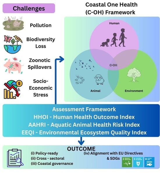
Coastal areas are under simultaneous pressure from pollution, biodiversity loss, climate change and zoonotic risks, with direct consequences for local communities and economies. The authors introduce a Coastal One Health (C-OH) framework that explicitly links human health, animal health and environmental ecosystem quality in a single structure.
Figure 1. Research Framework.
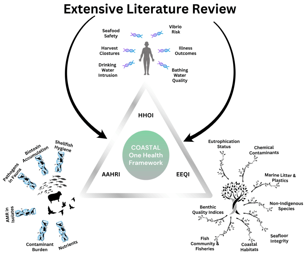
Building on and extending the well-known DPSIR (Drivers–Pressures–State–Impact–Response) model, the framework proposes three composite indicators:
Human Health Outcome Index (HHOI) – capturing links between environmental conditions, bathing water quality, seafood safety, disease outcomes and socio-economic well-being.
Aquatic Animal Health Risk Index (AAHRI) – reflecting disease risks, antimicrobial resistance and health status in farmed and wild aquatic animals.
Environmental Ecosystem Quality Index (EEQI) – integrating biodiversity, habitat condition, pollution load, water quality and climate-related stressors.
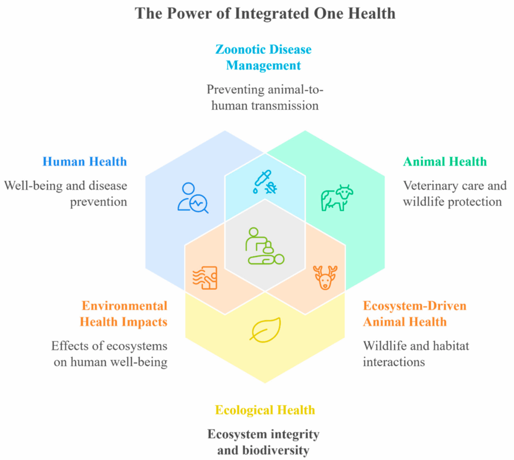
Figure 2. Integrated One Health: Connecting Human, Animal, and Ecosystem Well-Being.
These indicators are designed to be policy-ready and interoperable with existing monitoring and reporting under key EU directives (Water Framework Directive, Bathing Water Directive, Marine Strategy Framework Directive) and the UN SDGs (particularly SDG 3, 6 and 14). By combining environmental, health and socio-economic data, the C-OH framework aims to:
Support vulnerability assessment of coastal municipalities
Help compare and prioritise risks and interventions at local scale
Enable early warning and tracking of hazards such as harmful algal blooms, Vibrio outbreaks and AMR
This publication lays the conceptual and methodological foundations of the framework and provides the full indicator set. The next step will be to build and test the composite indices in practice, starting with a pilot application in Pagasitikos Gulf (Greece), with potential transfer to other coastal and even urban environments.
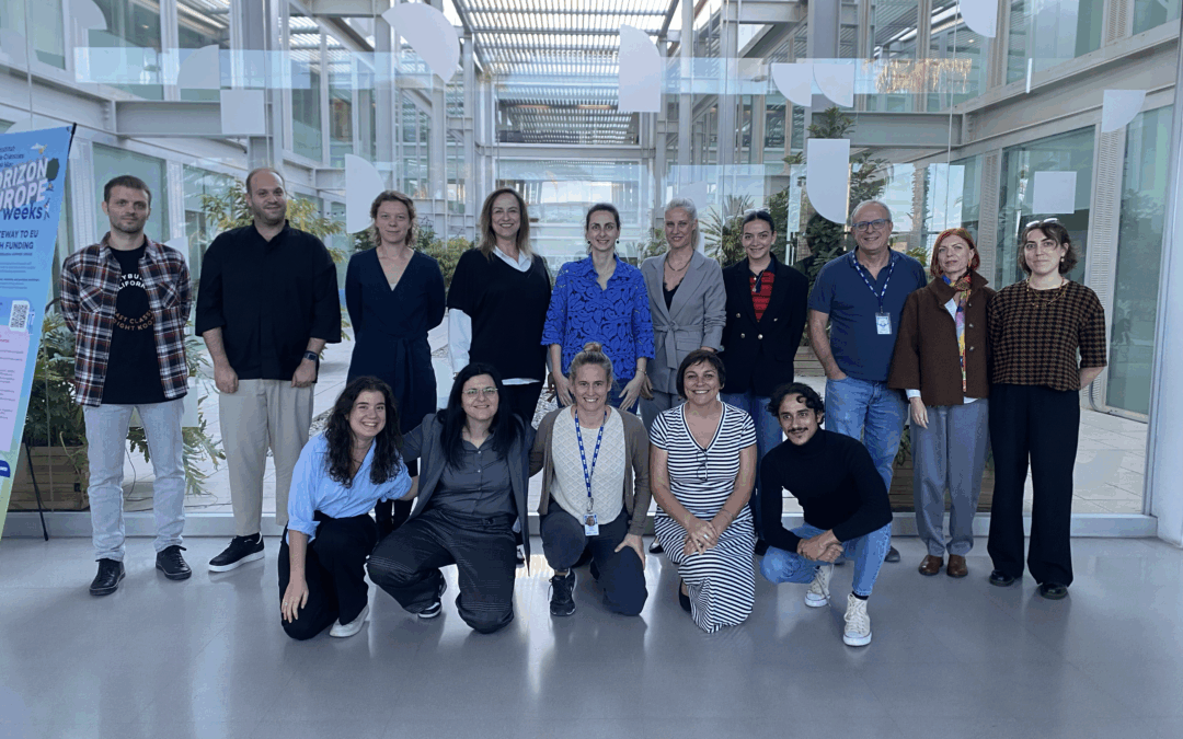
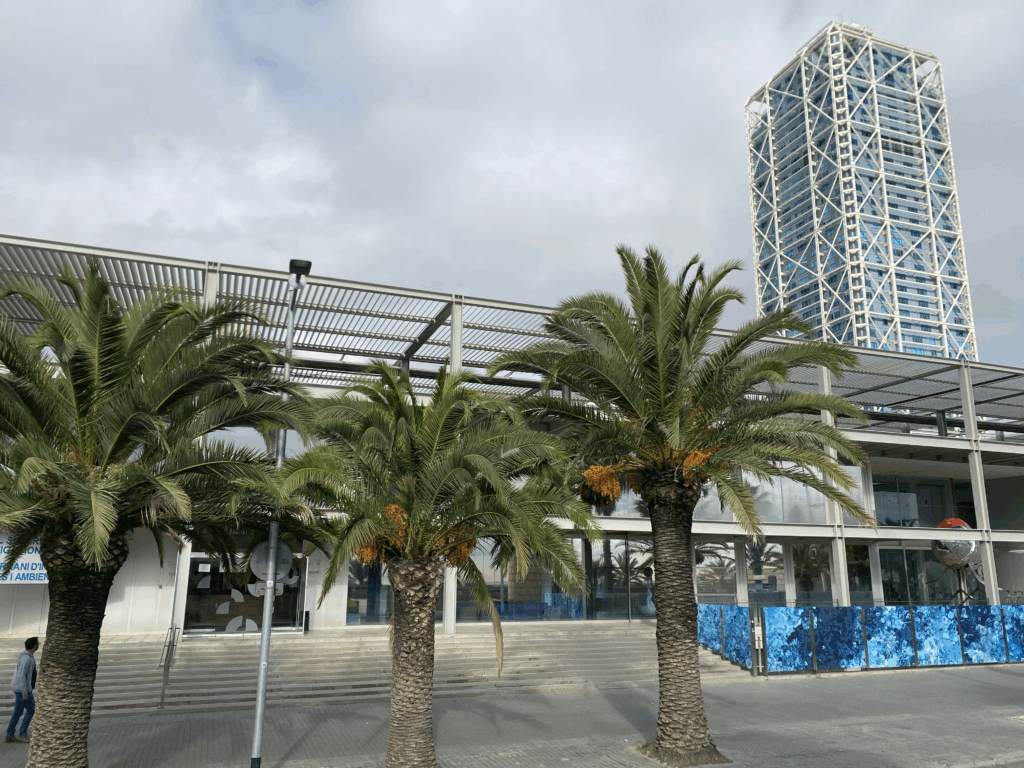
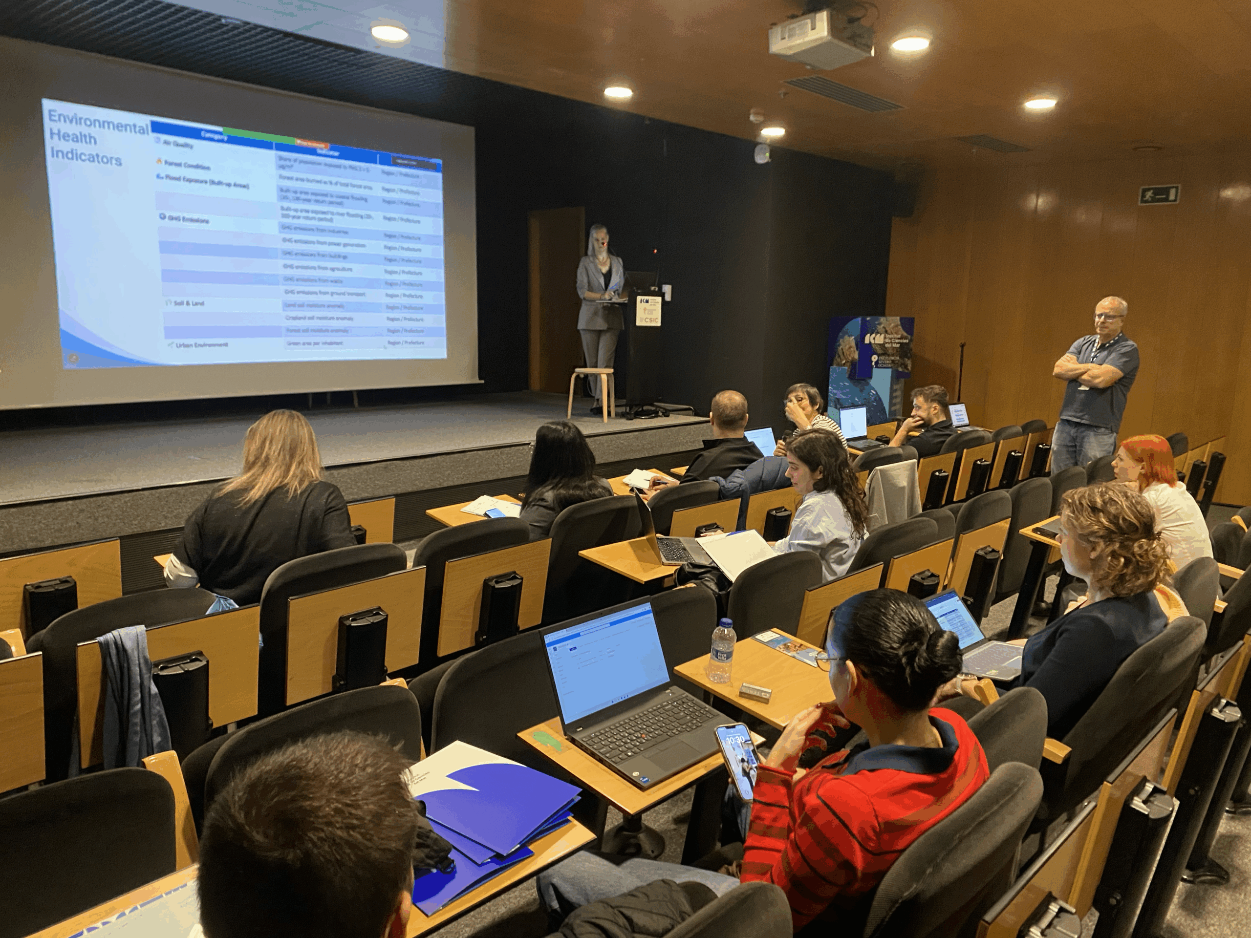
Barcelona, Spain – 3–4 November 2025 The ENHANCE consortium gathered in Barcelona for its second General Assembly, hosted by the Instituto de Ciencias del Mar (ICM-CSIC) and the EMBIMOS Research Group, marking two days of collaboration, review, and strategic planning for the year ahead.
The meeting brought together project partners from Greece, Spain, France, Belgium, and beyond, reaffirming ENHANCE’s commitment to sustainable and climate-resilient coastal management through the One Health approach. This integrated framework links the health of ecosystems, animals, and humans, ensuring that the wellbeing of coastal communities is considered alongside environmental and economic priorities.
Reviewing Progress and Planning Ahead
The first day, held at ICM-CSIC, focused on progress updates across ENHANCE activities. Partners presented advancements in:
The co-development of the One Health Framework for coastal management;
The design of AI-enabled tools integrating Copernicus and EGNSS data;
Ongoing stakeholder engagement through Living Labs and participatory approaches;
And the project’s communication, exploitation, and dissemination strategies.
As one of the EU-funded projects under the HORIZON-EUSPA-SPACE programme, ENHANCE leverages Earth Observation and citizen science to address environmental challenges in coastal areas. Its two Mediterranean case studies — Barcelona’s urban beaches and the Pagasitikos Gulf in Greece — serve as living examples of how data-driven decision-making can strengthen local resilience to urban, agricultural, and climate pressures.
ENHANCE at the Smart City Expo World Congress
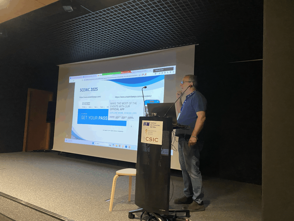
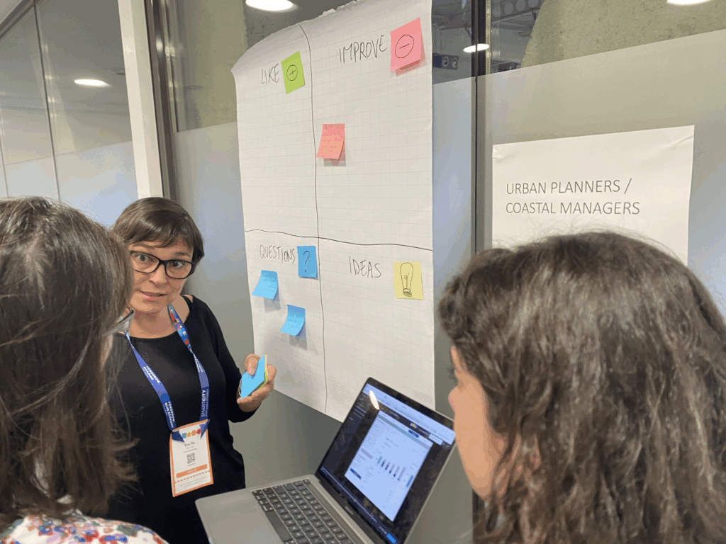
On the second day, the consortium took part in the Smart City Expo World Congress, the world’s leading event for urban innovation. ENHANCE was featured in two sessions showcasing how European innovation fosters inclusive and resilient coastal and urban futures:
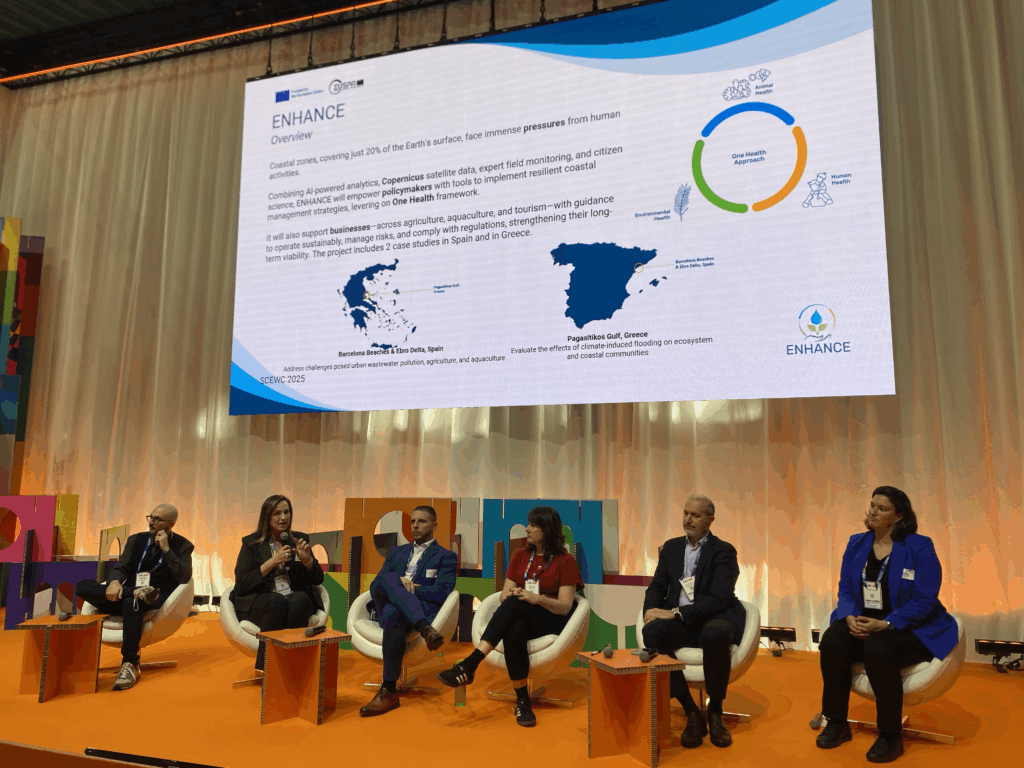
“Inclusive Innovation: Delivering Effective Solutions in Cities and Communities” – Prof. Chrysi Laspidou (University of Thessaly) represented ENHANCE in a panel discussion exploring how bottom-up initiatives and citizen participation drive sustainable innovation. She highlighted that: “Decision-making processes require bottom-up initiatives involving citizens to achieve tailored and efficient solutions.”
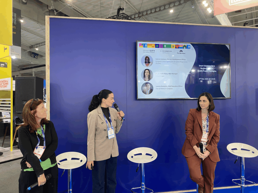
“Smart Solutions for a Resilient Europe: EUSPA Project Highlights” – Stamatia Rizou (SingularLogic) and Valeria Catalano (EUSPA) presented ENHANCE as part of a showcase of flagship projects harnessing space data and Earth Observation services to advance smart city development.
Defining the Road Ahead
The Barcelona meeting culminated in two internal workshops, during which partners refined the One Health Toolkit — ENHANCE’s key end product. This toolkit will provide practical decision-support services for policy makers and businesses, translating scientific innovation into actionable coastal management strategies.
As partners concluded the General Assembly, they left with clear implementation pathways and renewed momentum to deliver high-impact solutions for Europe’s coastal communities. The event also boosted ENHANCE’s visibility on the international stage, strengthening its ties with stakeholders and institutions working at the intersection of space, AI, and environmental sustainability.
Researchers from the University of Thessaly (UTH) — Alexandra Ioannou, Evmorfia Bataka, Nikolaos Kokosis, Charalambos Billinis, and Chrysi Laspidou — have published the first comprehensive bibliometric review of how the One Health framework is applied in coastal and marine ecosystems.
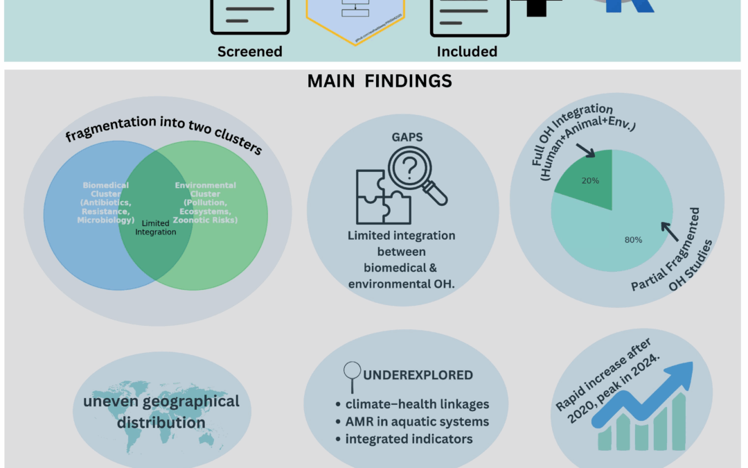
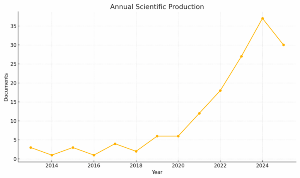
Analyzing over 150 publications from 2003–2025, the study reveals a rapid surge in research after 2020, peaking at 37 papers in 2024, but finds that fewer than 20% of studies fully integrate human, animal, and environmental health dimensions.
Annual scientific production on One Health in coastal and marine contexts (2013–2025). The output remained low and inconsistent until 2018, then increased sharply after 2020, peaking at 37 publications in 2024 and maintaining high levels in 2025.
Main findings:
Research remains divided between biomedical (antibiotics, antimicrobial resistance, microbiology) and environmental (pollution, microplastics, eutrophication, HABs) clusters.
Scientific output is concentrated in high-income countries such as the USA, Brazil, and the UK, while low- and middle-income coastal regions remain underrepresented.
Only a handful of journals serve as core publication outlets, highlighting both growth and fragmentation in the field.
Climate–health linkages and integrated indicators such as chlorophyll-a and microplastics are underexplored, despite their relevance for policy and monitoring.
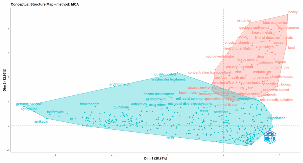
Two main clusters are identified: (i) a biomedical and microbiological cluster on the left, centered on antibiotics, resistance mechanisms, and clinical studies; and (ii) an environmental cluster on the right, associated with heavy metals, microplastics, and ecosystem-related terms.
“Our findings highlight both the promise and the imbalance of One Health research in coastal systems,” said lead author Chrysi Laspidou. “To protect both ecosystems and communities, we must build stronger bridges between environmental and biomedical research — and ensure that vulnerable coastal regions are not left behind.”
The study provides an evidence base for embedding One Health into coastal monitoring, climate adaptation, and governance, contributing to progress toward the UN Sustainable Development Goals.