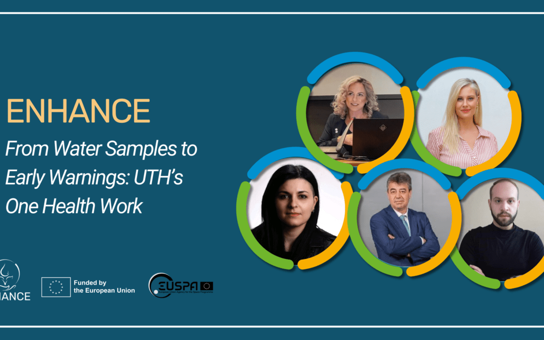
Coastal communities depend on healthy seas for food, recreation, local livelihoods, biodiversity and cultural identity. At the same time, coastal waters face increasing pressure from floods, urban runoff, agriculture, tourism, aquaculture and climate change. In ENHANCE, the University of Thessaly (UTH) team is working to turn local water-quality measurements, fish tissue analysis, satellite observations and modelling into practical information that can support coastal management.
The work focuses on the Pagasitikos Gulf, a semi-enclosed coastal system in central Greece that was strongly affected by the catastrophic floods in Thessaly in September 2023. The key question is simple: how can we understand whether a coastal system is recovering, and how can we provide earlier warning when water quality begins to deteriorate?
Section 1: A recent scientific milestone: a Coastal One Health framework
A milestone for the UTH team is the publication of a One Health (OH) framework for coastal areas (Ioannou et al., 2025b) bringing the gap identified in their earlier publication (Ioannou et al., 2025a). OH means looking at human health, animal health and ecosystem health holistically, rather than treating them as separate issues. This is especially important after extreme events. Flood runoff can change turbidity and salinity, carry nutrients or pollutants, affect fish and shellfish, and influence bathing-water quality. A coastal-management system should therefore look at the combined picture, not only at one variable such as chlorophyll-a or temperature.
Section 2: From local evidence to early warning
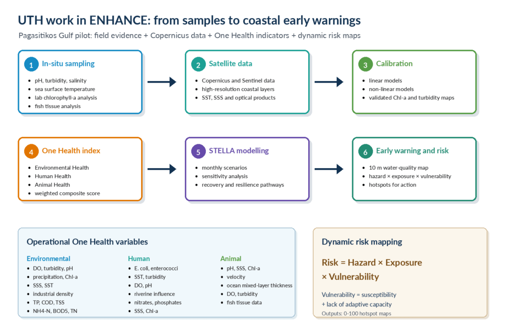
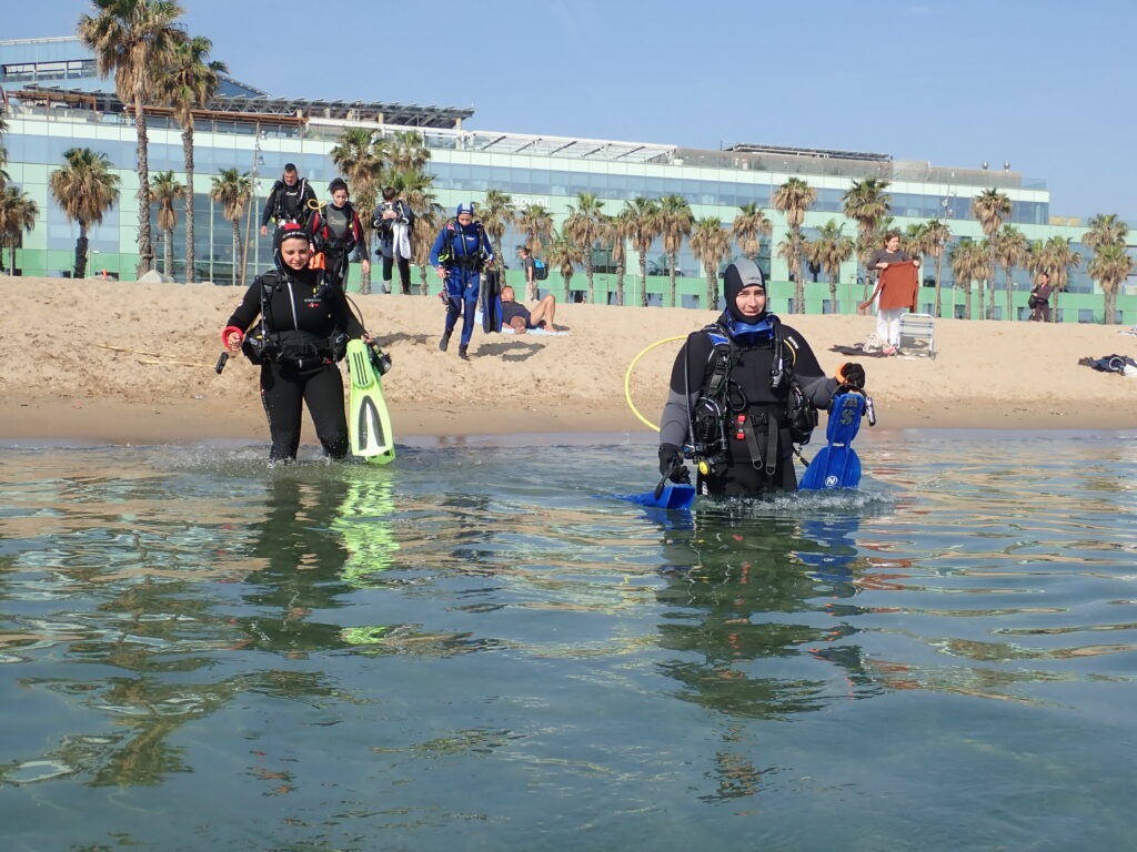
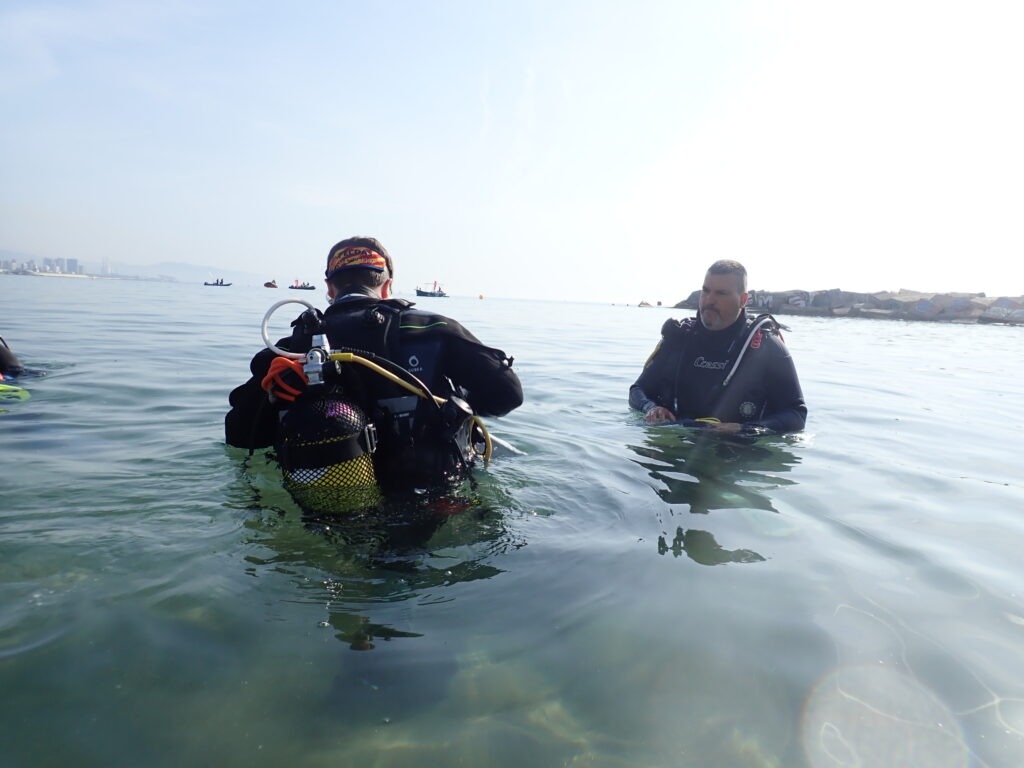
The first building block is field evidence. UTH collects water samples and in-situ measurements from the Pagasitikos Gulf to capture real conditions in the water. These measurements include pH, turbidity, salinity, sea surface temperature and laboratory-determined chlorophyll-a from water samples. Sampling is carried out at fixed stations and is coordinated with Sentinel satellite overpasses. Alongside the in-situ water-quality measurements, fish tissue analysis will also be carried out, adding an animal-health line of evidence to the OH assessment and helping link environmental conditions with biological information from the Gulf.
ENHANCE uses Copernicus and Sentinel data to produce high-resolution water-quality layers for coastal waters. For the Pagasitikos Gulf, satellite-derived values will be compared with UTH field and laboratory measurements. Linear and non-linear calibration models will be tested, because coastal waters can show complex relationships between sediments, algae, river inputs and shallow-water effects. The expected outcome is a better-calibrated set of satellite products for variables such as chlorophyll-a and turbidity, supporting faster detection of unusual water-quality changes across a wider area than field sampling alone.
Visual: UTH ENHANCE workflow from field sampling to early warning
Figure 1. UTH workflow for the Pagasitikos Gulf pilot, combining in-situ sampling, fish tissue analysis, Copernicus satellite data, One Health indicators and dynamic risk maps.
Section 3: Operational One Health indicators
The published framework provides the conceptual structure; the ENHANCE pilot is adapting it for operational use in the Pagasitikos Gulf. The current OH indicator will combine variables from three connected dimensions:
Human Health: E. coli, intestinal enterococci, temperature, turbidity, dissolved oxygen, pH, river influence, nitrates, phosphates, salinity and chlorophyll-a.
Animal Health: pH, salinity, chlorophyll-a, water velocity, mixed-layer thickness, dissolved oxygen, turbidity and fish tissue analysis.
These variables are weighted and aggregated into a composite signal. The purpose is not to reduce a complex ecosystem to a single number, but to create a clear, comparable indication that can support discussion, monitoring and action.
Section 4: Modelling scenarios and risk maps
UTH will also contribute through system dynamics modelling in STELLA Architect, an approach suited to representing interactions between environmental pressures and their impacts. For the Pagasitikos Gulf pilot, the model will link rainfall patterns, riverine inputs and water-quality changes with ecosystem stress, bathing-water risks and management responses. Sensitivity analysis will identify the parameters that most strongly influence system behaviour, while resilience analysis will assess the system’s capacity to absorb disturbances, maintain key functions and recover after events such as intense rainfall, stronger river inflows or sudden water-quality shifts. Future scenarios will test how the Pagasitikos Gulf responds to extreme events: will the system break, or will it bend and bounce back? This work will support evidence-based decision-making.
The risk-map methodology complements the water-quality early-warning system. It follows a simple climate-risk logic: risk increases where hazard, exposure and vulnerability coincide. Hazards may include flooding, storm surge, extreme rainfall or sea-level rise. Exposure refers to people, infrastructure, tourism facilities, agricultural land and ecosystems located in risk-prone areas. Vulnerability captures susceptibility and lack of adaptive capacity. The final outputs can be presented as 0-100 risk maps, highlighting hotspots where monitoring, preparedness or intervention should be prioritised.
Conclusion
UTH’s work in ENHANCE demonstrates how coastal monitoring can become more integrated, locally grounded and actionable. Field sampling and fish tissue analysis generate site-specific evidence; satellite data expand spatial coverage; One Health indicators provide a structured way to interpret environmental, animal and human health signals; and system-dynamics modelling and risk maps translate complex information into practical guidance for decision-makers. By bringing these elements together, ENHANCE supports a broader goal: resilient Mediterranean coastal areas where scientific evidence helps safeguard ecosystems, animal health, public health and local livelihoods. The Pagasitikos Gulf pilot is therefore more than a case study; it is a living example of how a One Health approach can support coastal recovery, preparedness and climate resilience.
Further reading
Ioannou, A.; Bataka, E.; Kokosis, N.; Billinis, C.; Laspidou, C. (2025a). One Health in Coastal and Marine Contexts: A Critical Bibliometric Analysis Across Environmental, Animal, and Human Health Dimensions. International Journal of Environmental Research and Public Health, 22, 1523. https://doi.org/10.3390/ijerph22101523
Ioannou, A.; Bataka, E.; Kokosis, N.; Kofinas, D.; Billinis, C.; Laspidou, C. (2025b). A Holistic One Health Assessment Framework for Coastal Areas. Sustainability, 17, 9359. https://doi.org/10.3390/su17219359
Ioannou, A.; Bataka, E.; Kokosis, N.; Patsioura, G.; Laspidou, C. (2025). Development of ENHANCE One Health Framework for Coastal Management. ENHANCE Deliverable 2.1, Horizon Europe grant no. 10113447.
Figure 2. On the first row from the left to the right: Alexandra Ioannou, Charalambos Bilinis, Chrysi Laspidou. On the second row from the left to the right: Evmorfia Bataka, Nikolaos Kokosis.
Author(s) Bio:
Alexandra Ioannou: Postdoctoral Researcher, Department of Civil Engineering, University of Thessaly. Within ENHANCE, Alexandra is responsible for developing and operationalising the Coastal One Health framework and composite indicator. Her work also includes system-dynamics modelling in STELLA Architect, sensitivity and resilience analysis, and future climate-change scenario modelling, with the aim of translating scientific evidence into decision-support tools for coastal management.
Evmorfia Bataka: Postdoctoral Researcher, Department of Civil Engineering, University of Thessaly. Within ENHANCE, Evmorfia is responsible for the development of sampling protocols and water-quality indices, the implementation of in situ sampling campaigns in Pagasitikos Gulf, laboratory analyses, the retrieval and processing of data from Copernicus and local monitoring platforms, and the development of calibration models for satellite-derived water-quality products using local in situ data.
Nikolaos Kokosis: PhD Candidate, Department of Civil Engineering, University of Thessaly. Within ENHANCE, Nikolaos contributes to the development of a multi-hazard assessment framework for coastal communities, focusing on the establishment of a geospatial database, the quantification and spatial representation of coastal risk, and the creation of thematic maps that support the identification of vulnerable areas and the prioritization of decision-making.
Charalambos Billinis: Professor, Faculty of Veterinary Medicine, University of Thessaly; contributes veterinary and animal-health expertise to the One Health perspective.
Chrysi Laspidou: Professor, Department of Civil Engineering, University of Thessaly; leads and coordinates UTH scientific contributions to ENHANCE.
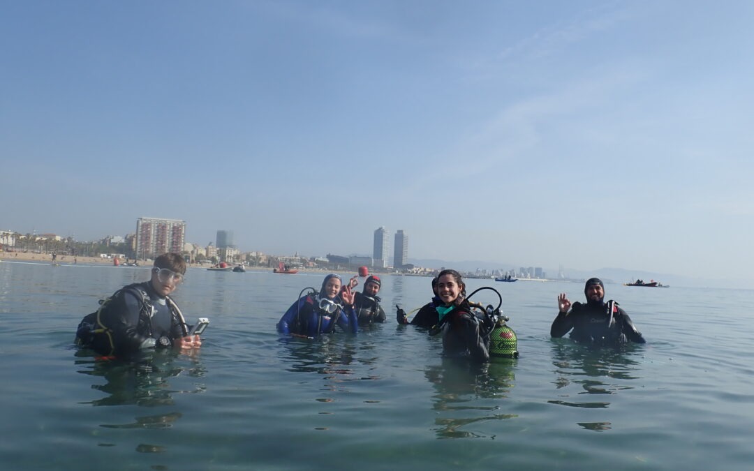
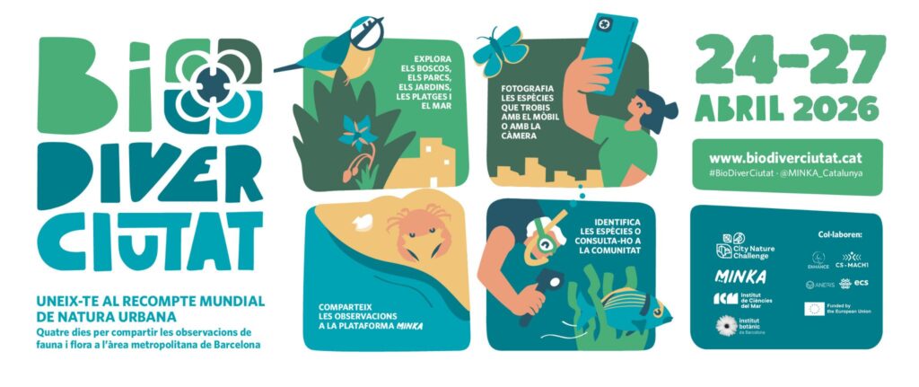
The Barcelona Metropolitan Area joins the global City Nature Challenge with more than 3,200 biodiversity observations through the MINKA platform
From April 25 to 28, the EMBIMOS research group from the Institut de Ciències del Mar (ICM-CSIC), together with the Institut Botànic de Barcelona (IBB), coordinated a new edition of BioDiverCiutat, the Barcelona Metropolitan Area’s contribution to the international City Nature Challenge. This was the first edition co-organised with the IBB, strengthening the collaboration between marine and terrestrial biodiversity research communities.
This edition of BioDiverCiutat was supported by the European projects ECS, ANERIS, CSMACH1 and ENHANCE.
During the four-day event, 53 participants recorded more than 3,270 biodiversity observations through the MINKA citizen science platform, documenting a total of 794 species across the metropolitan region.
According to the official City Nature Challenge 2026 results, the Barcelona Metropolitan Area ranked 204th worldwide in number of species recorded among the 754 participating cities globally. In Spain, 19 municipalities participated in the challenge, including Alicante, Pamplona, Sevilla and Zaragoza, among others. Barcelona once again ranked first in the country both in number of observations and number of species recorded.
The observations collected during the event reveal the remarkable biodiversity still present in urban and peri-urban environments. Marine species represented 57% of the documented biodiversity, while terrestrial species accounted for 43%. Plants were the most represented group, followed by insects and molluscs, especially marine molluscs.
New biodiversity records and notable findings
The BioDiverCiutat2026 dataset generated several significant biodiversity findings. A total of 90 non-native species were documented, including 35 considered invasive according to the EXOCAT information system for alien species in Catalonia. Among the most notable observations were the invasive Asian hornet (Vespa velutina), the Asian brown alga (Rugulopteryx okamurae), and the invasive coral Oculina patagonica.
The event also documented 42 protected species, including two threatened species listed under Catalan conservation regulations: Audouin’s gull (Ichthyaetus audouinii), classified as endangered, and the little owl (Athene noctua), classified as vulnerable.
In addition, 10 species were identified for the first time on the MINKA platform, most of them insects and marine molluscs. Several marine molluscs and algae represented particularly relevant records for the Barcelona coastline, including Elysia translucens, Goniodoridella picoensis, Tayuva maculosa, and the alga Dictyota dichotoma var. intricata.
The observations also highlighted the scientific value of citizen science for biodiversity monitoring. Of the 685 strictly identified species recorded during the challenge, 110 had not previously been cited in the Biodiversity Data Bank of Catalonia (BDBC) within the metropolitan area, while 11 species were not previously registered in GBIF for the same area. Researchers summarised these findings as six species newly recorded for the Barcelona coastline.
Credit: Andrea ComaposadaCredit: Andrea Comaposada
Urban biodiversity through citizen science
Despite restricted access this year to parts of Collserola Natural Park, which may have reduced terrestrial participation, the event documented a highly diverse range of organisms including plants, insects, molluscs, birds, fish, crustaceans, sponges, and tunicates.
The final dataset included:
284 plant taxa
109 insect taxa
85 mollusc taxa
67 bird taxa
52 fish taxa
27 crustacean taxa
15 sponge taxa
15 tunicate taxa
Globally, the City Nature Challenge 2026 brought together 106,354 participants across 754 cities in 61 countries and 6 continents, generating more than 3 million biodiversity observations and documenting over 75,000 species worldwide. The Common Dandelion (Taraxacum officinale) was once again the world’s most observed plant species, while the Mallard (Anas platyrhynchos) ranked as the most observed animal species.
About the event
BioDiverCiutat is a citizen science initiative that invites people to discover and document urban biodiversity through the MINKA platform. The event forms part of the global City Nature Challenge, an international competition encouraging cities worldwide to collectively record as much biodiversity as possible over four days. The initiative demonstrates the important role that citizens can play in biodiversity monitoring, environmental awareness, and conservation research.
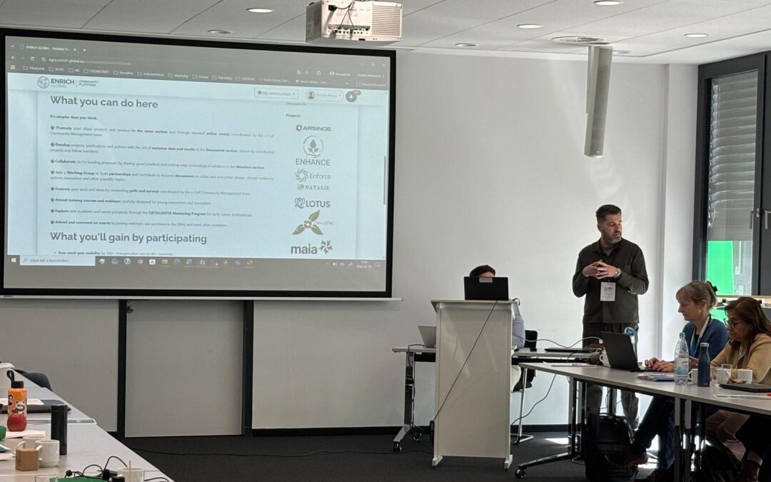
On 16–17 April 2026, the ENHANCE project was presented during the ENRICH GLOBAL 4th Innovation Days, held in Bonn, Germany, at the German Aerospace Centre (DLR) Project Management Agency. The in-person event brought together ENRICH GLOBAL members and associated organisations from across Europe and Latin America to exchange knowledge, strengthen collaboration and explore innovation support opportunities.
Representing ENHANCE, Giannis Adamos introduced the project’s innovation ecosystem to participants as part of broader discussions on ENRICH GLOBAL’s thematic communities, collaboration tools and innovation support services.
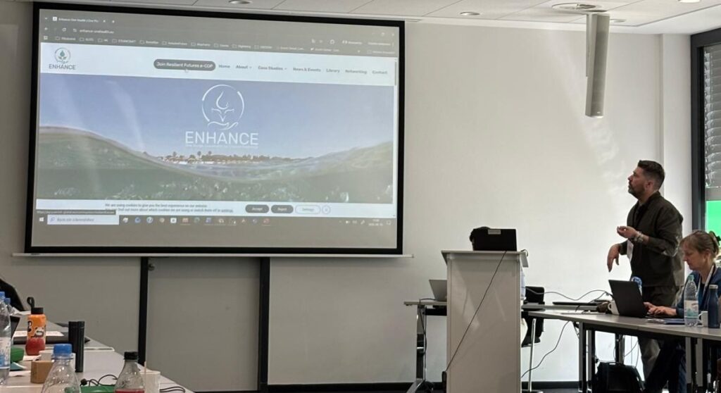
Giannis Adamos, Chair of Resilient Futures e-CoP introducing ENHANCE website to the audience of the EG Innovation Days 2026
The presentation highlighted the ENHANCE platform, toolkit and the ENHANCE Hub hosted within the Resilient Futures e-Community of Practice (e-CoP). Participants were introduced to the project’s approach to supporting stakeholder engagement, knowledge exchange and impact creation through digital collaboration and networking tools.
The event also provided an opportunity to explore synergies between ENHANCE and ENRICH GLOBAL’s wider international network. By presenting the ENHANCE Hub and toolkit to organisations from different sectors and regions, the project strengthened its visibility among innovation and research support actors while opening pathways for future cooperation and community-building activities.
Networking activities during the event involved several ENHANCE partners and representatives, including Chrysi Laspidou, Inna Petrenko, Oihana Luque, Svetlana Klessova and Giannis Adamos. Their participation contributed to reinforcing connections with organisations active in innovation ecosystems, research collaboration and knowledge transfer.
The ENRICH GLOBAL 4th Innovation Days programme featured participants from member organisations and associated partners based in countries including France, Germany, Spain, Belgium, Hungary, Portugal, Ecuador and Austria, creating a valuable environment for international exchange and collaboration.
Through its participation in the event, ENHANCE continued to promote its mission of fostering resilient and collaborative innovation ecosystems while expanding opportunities for engagement with international stakeholders and networks.
How do we ensure that ENHANCE tools deliver reliable, usable, and actionable One Health information?
Deliverable D4.1 – Evaluation Methodology & Test Scenarios defines the framework that will guide the assessment of ENHANCE services across the three case studies . It establishes how technical performance, user experience, and socio-economic impact will be measured throughout the pilot phases.
The document translates the One Health framework into concrete evaluation scenarios for:
Barcelona urban beaches (CS1-A)
Ebro Delta (CS1-B)
Pagasitikos Gulf (CS2)
For each case study, D4.1 specifies:
The selected One Health indicators (human, animal, environmental health)
The associated data sources (Copernicus EO, citizen science, in-situ monitoring, laboratory analysis)
The user profiles involved through Living Labs
The expected ENHANCE products, from turbidity and chlorophyll-a maps to biodiversity indicators and composite risk indices
Beyond defining what will be tested, the deliverable structures how performance will be assessed.
A multi-dimensional evaluation framework
D4.1 introduces a comprehensive evaluation model built on three pillars:
1. Technical performance Verification of satellite-derived products, AI-assisted classification tools, and composite indices such as:
The Human Health Outcome Index (HHOI)
The Aquatic Animal Health Risk Index (AAHRI)
The Environmental Ecosystem Quality Index (EEQI)
A Coastal One Health Assessment Index
2. User experience (UX) Structured task-based testing sessions in each pilot site assess:
Usability and clarity of maps and dashboards
Ability to interpret indicators
Likelihood of future use
3. Socio-economic and stakeholder adoption A dedicated KPI framework evaluates:
The evaluation workflow is iterative, supporting two pilot waves and continuous refinement of tools between M20 and M27 .
D4.1 ensures that ENHANCE is not only technically robust, but also operationally relevant and socially embedded. It provides the methodological backbone that will validate the project’s impact in real coastal contexts and prepare the ground for replication beyond the pilot regions.
How does ENHANCE transform data into operational intelligence for coastal management?
Deliverable D3.1 – ENHANCE Open One Health Core Platform presents the first release of the project’s core digital infrastructure — the backbone that enables data integration, AI processing, and risk assessment services .
This deliverable translates the conceptual architecture and user requirements defined in WP2 into an operational, cloud-native platform designed to ingest, manage, analyse, and expose environmental and citizen-generated data.
D3.1:
Defines the high-level architecture of the ENHANCE platform, covering data acquisition, management, AI analytics, and visualisation layers
Details a secure identity and access management system based on OpenID Connect and Keycloak, ensuring role-based and GDPR-aligned data governance
Describes the storage and integration layers, built on MinIO (object storage), MongoDB (metadata registry), and a REST API backbone
Explains the deployment model using Docker and Kubernetes, ensuring scalability, modularity, and interoperability
Documents operational pipelines for pressure and impact assessment, including:
Satellite-based chlorophyll-a retrieval from Sentinel-2 imagery
AI-driven biodiversity monitoring from citizen observations
Early-warning indicators for turbidity and algal blooms
Introduces methodologies for dynamic risk mapping, including the Pressure–Impact–Management (PIM) approach and a multi-hazard coastal risk index
The deliverable demonstrates how heterogeneous data — Copernicus Earth Observation, in-situ measurements, and citizen science inputs — are structured into a secure, interoperable ecosystem capable of generating decision-ready outputs .
D3.1 marks the transition from platform design to operational deployment. It establishes the technical foundation upon which ENHANCE services, AI models, and interactive user interfaces will be built and validated in the two pilot regions.